It started with a discussion. “Let’s find a place in Colorado where we haven’t been. Where can we go where we are in the mountains and it’s not more than an 8 hour drive?” When you live in Amarillo, that can be answered with Twin Lakes, Colorado.

It took about 8 hours or so with stops. Or maybe a bit longer, since part of that drive was directly in the path of wildfires.


We weren’t even positive we could get through on the route we planned. After stopping to snap a few photos and conversing with a local woman who dropped her kids off at summer camp just 12 miles from the fire (!!!), we decided to keep driving up the road. I have to admit, it was alarming to drive through a billowing cloud of smoke! We drove directly past the mountains, edged in flames along its ridge, then north, north, north; finally up to more clear skies.

The drive was beautiful; some of the loveliest Colorado country I’ve seen. There were cute little towns, like Salida & Buena Vista along the way. Maybe a bit tourist-y, but cute all the same, with little shops, cafès and the Arkansas river running through downtown.

The Arkansas river originates in the Rocky Mountains in Lake County, Colorado, near Leadville (just North of where we camped) and is a major tributary of the Mississippi River. This area is a well-known rafting spot.
We arrived at our destination in the early evening hours and chose a campground.

These two photos were taken from dispersed camping, where we ultimately decided NOT to camp, in hopes of being closer to water further up the road: (Even though the view tempted us, there was not a lot of shade)


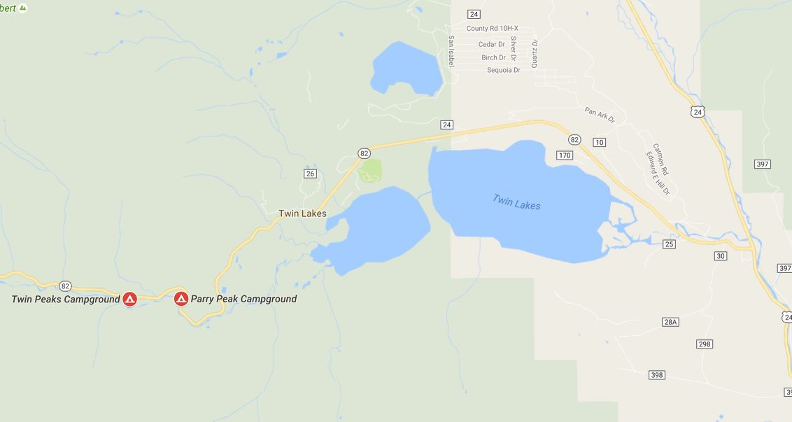
See the end of the post for a map on how to get to these sites.
We continued around the lakes, where we settled on Parry Peak Campground:


Although our site was right off the road (kind of loud with traffic), it was also right next to the river:


It was chilly, even in July; after all, we were in the mountains!

We fished a little, although we didn’t catch anything. It was still a pleasant morning by the water. We were given a tip by a girl working at the camp store; she told us to cross the dam and fish on the southern side of the lake. It was peaceful, but the ants were a bit out of control. Poor Sprockette had a hard time trying to get away from them. He found the water to be the best answer.

After fishing, Matt suggested we take a scenic drive that looped from the lakes up and over and down through Aspen, across the continental divide and back down to the lakes. I obliged. 🙂


I think the loop took about 4 hours. We traveled North to Leadville, where we stopped and walked around. It was another cute little mining town with lots of shops and tourist attractions. (We had hoped to stop for a beer at the local brewery, but discovered it to be temporarily closed due to a new coat of exterior paint being applied.)

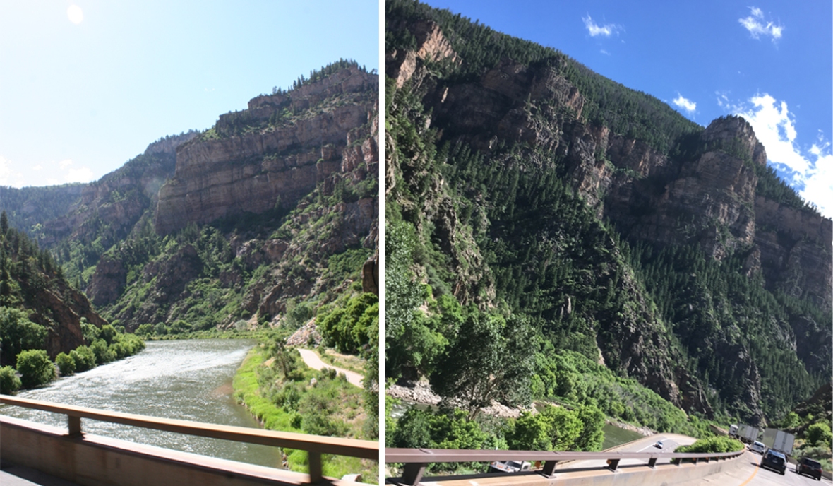
I-70 proved to be quite stunning near Glenwood Springs. Just a tip for anyone traveling this road: there’s a rest stop before entering Glenwood Springs. By all means, stop there to pee and take in the beautiful views! Glenwood Springs is kind of a nightmare in that it’s a small town on the interstate, is undergoing construction, full of traffic and pedestrians and the turn-off to head south to Aspen.
The drive continued to be stunning as we wound southeast through the mountains and aspens.

Woo-wee, was it COLD way up on Independence Pass!


Even though this was a lot of driving and exploring to pack into a 3-day trip, it was worth it to be in the mountains. And, it was the last camping trip we were able to take our dog on. He was feeling a bit tired on this trip, and when we returned home, we discovered he was very ill. I feel very fortunate that we had the opportunity to have him along one more time in the mountains. He loved the water and the cool mountain air.

Here are some tips and links if you plan on visiting the area:
Independence Pass
The town of Salida
Buena Vista Rafting Tours (I’m recommending this place because my friend works here 😉Leadville’s National Mining Hall of Fame and Museum
Twin Lakes fishing info
Parry’s Peak Campground info
Lakeview Campground
We ran across dispersed camping above the lake, which I think I was able to mark on this map with purple. There were a lot of side roads, but it’s a good place to explore! I suggest taking some good maps or printing them out before you go since phone reception is very spotty.

